
New London County ZIP Coverage
New London County is a geographic frame made up of 21 towns, not a county postal district. The working list below is intentionally conservative. It combines the official post-office references with documented village, finance-unit, facility, and edge-area clues, and it flags entries that need an exact-address check. A ZIP code can be useful for narrowing a search, but USPS delivery geography does not decide which town clerk, assessor, registrar, or court holds a record.
| ZIP Code | Areas Covered | Post Office / Label | Notes |
|---|---|---|---|
| 06249 | Lebanon | Lebanon | County-edge postal geography |
| 06254 | North Franklin | North Franklin | Listed postal name |
| 06320 | New London | New London | City postal code |
| 06330 | Baltic | Baltic | Village and post-office label |
| 06333 | East Lyme | East Lyme | Town and post office |
| 06334 | Bozrah | Bozrah | Delivery use expanded in 2019 bulletin |
| 06335 | Gales Ferry finance | Gales Ferry | Finance-unit label |
| 06336 | Gilman | Gilman | Postal label |
| 06338 | Mashantucket | PO-box or facility use | Verify the exact address with USPS |
| 06339 | Gales Ferry and Ledyard | Gales Ferry | Town and village routing |
| 06340 | Groton and branches | Groton | Borough, Groton Long Point, and Noank references |
| 06349 | Submarine Base Groton | Submarine Base | Unique institutional postal clue |
| 06350 | Hanover | Hanover | Postal label |
| 06351 | Jewett City | Jewett City | Borough and postal label |
| 06353 | Montville | Montville | Town and post office |
| 06355 | Mystic | Mystic | Village, not one legal town |
| 06357 | Niantic | Niantic | East Lyme postal label |
| 06359 | North Stonington | North Stonington | Town and post office |
| 06360 | Norwich | Norwich | City postal code |
| 06365 | Preston | Preston | USPS verification needed in the research pass |
| 06370 | Oakdale | Oakdale | Montville-area postal label |
| 06371 | Old Lyme | Old Lyme | Town and post office |
| 06372 | Old Mystic | Old Mystic | Village and postal label |
| 06375 | Quaker Hill | Quaker Hill | Waterford-area route clue |
| 06376 | South Lyme | South Lyme | Lyme-area route clue |
| 06378 | Stonington finance | Stonington | Finance-unit label |
| 06379 | Pawcatuck | Pawcatuck and Stonington | Postal label differs from town name |
| 06380 | Taftville | Taftville | Norwich-area route clue |
| 06382 | Uncasville | Uncasville | Montville-area route clue |
| 06383 | Versailles | Versailles | Postal label |
| 06384 | Voluntown | Voluntown | Town and post office |
| 06385 | Waterford | Waterford | Town and post office |
| 06388 | West Mystic | West Mystic | USPS location record shows 06388-9992 |
| 06389 | Yantic | Yantic | Delivery use expanded in 2019 bulletin |
| 06415 | Colchester | Colchester | Town and post office |
| 06420 | Salem | Salem | Verify current USPS address mapping |
| 06439 | Hadlyme | Hadlyme | Lyme-area postal label |
| 06474 | North Westchester | North Westchester | USPS verification needed in the research pass |
The table supplies 38 conservative ZIP clues, not a promise that every code covers every address under the named label. The USPS lookup should settle a full street address, unit, and city/state combination before a person or parcel search begins. Treat the table as an index of questions to verify, not as a legal boundary map.
Postal Labels in New London County
The Secretary of the State’s Connecticut post-office list includes offices, branches, stations, finance units, and stores. That is why a postal label can look like a separate place while remaining a route or facility clue. Baltic, Jewett City, Taftville, Yantic, Pawcatuck, and West Mystic are useful search terms, but a deed, assessment card, voter record, or vital certificate is routed by legal town.
Use the official USPS ZIP Code Lookup for an address, a city and state, or a list of cities by ZIP. The By City and State result can return multiple codes, and a city name can be a village, borough, or delivery label. The safest handoff records the USPS output separately from the municipality chosen for the next records office.
New London County’s no-county-clerk structure makes that separation practical. Once the town is known, land records go to the town clerk, parcel context to the assessor or GIS, voter questions to the town registrar or state lookup, and court questions to the Judicial Branch district or probate district.
USPS Fields for New London County ZIPs
USPS offers three useful search modes. By Address is the best first check when a person, parcel, or family record is tied to a street. By City and State helps discover postal possibilities, but it can be broad. Cities by ZIP works in the other direction and can show why one code has more than one place label.
| By Address | Street is required; company, unit, city, state, and ZIP fields are available as applicable. |
|---|---|
| By City and State | City and state search can return multiple ZIP codes or postal destinations. |
| Cities by ZIP Code | Starts with a ZIP and returns associated city or postal names. |
| Unit and company | Useful for apartment, suite, facility, or business delivery distinctions. |
| Result use | Validate delivery formatting; do not treat the postal answer as a civil-town ruling. |
A ZIP+4 extension can sharpen delivery routing, but it does not turn a postal address into a parcel identifier. If the result names Mystic, Pawcatuck, Gales Ferry, or another village, keep the postal label in one field and resolve the town before opening a deed, voter, or vital record search.
Find New London County Residents by ZIP
There is no confirmed public countywide resident roster that can be filtered by ZIP. A careful ZIP search moves through the available access channels and stops short of creating a mass people list. Assessor and GIS tools can help inspect parcels, but the New London VGSI and MapGeo field sets are dynamic, and the research capture did not confirm a countywide ZIP filter. The state voter lookup is person-and-town based, not an open ZIP browser.
- Validate the full street address, unit, city, state, and ZIP with USPS. Save the postal result and the date.
- Resolve the legal town, then open the applicable assessor or GIS viewer. Inspect the parcel, owner or taxpayer role, situs, mailing destination, and map context one parcel at a time.
- Use the town clerk, the Cott RecordHub selector, or the legacy Connecticut Town Clerks Records portal for deeds, liens, trade names, and other municipal filings. A ZIP does not replace the town selection.
- For a named person, run the state voter lookup with the town, last name, first name, and date of birth. The restricted full-file route is described in the SOTS voter-file request form. Do not scrape the individual lookup into a ZIP roster.
- For older names, shift to a library, historical society, newspaper, directory, or State Archives search with the exact town and year.
When a ZIP narrows the starting point to a street, the New London County street directory carries the address-keyed parcel and deed workflow. It is more precise than treating a postal code as a list of everyone who lives nearby.
MapGeo Parcel Clues in New London County
The City of New London MapGeo viewer is useful after USPS has supplied a plausible address. Its visible tools include Property Quick Search, Search, Selection, Themes, Markup, Abutters, Zoom To, Share, and Print. The map can orient a researcher to a parcel and nearby parcels, but the city’s disclaimers describe the information as approximate and require independent verification. A map shape is not a survey, and an abutter set is not a resident roll.
The New London MapGeo viewer screenshot shows the parcel-map interface, including the controls that help connect a postal clue to a municipal parcel.
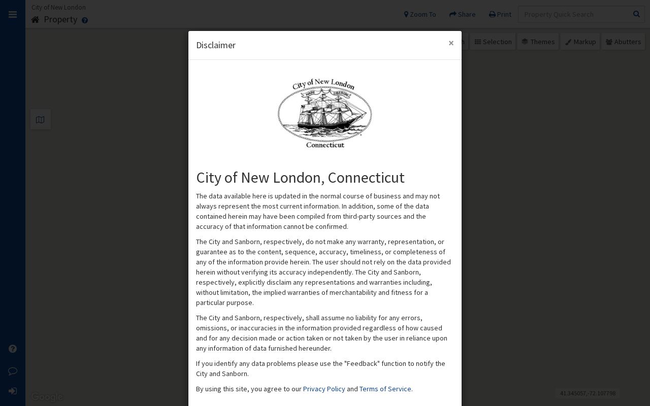
Use the selected parcel ID, town, layer, and map date as the handoff to the assessor or clerk. Do not infer a legal town from the map’s visual center or from a nearby postal label.
New London County SECOG Layers
The regional SECOG GIS viewer helps when a ZIP clue sits near a town line or when nearby parcels matter. It offers 2D and 3D views, layer and overlay themes, property search, find-abutters tools, mailing-list creation, and map or survey search across participating municipalities. Those tools can show how a delivery route relates to a parcel set, but they do not convert the region into a county people index.
The SECOG regional GIS viewer screenshot shows the regional layer and abutter workflow. The active map, municipality, and data layer control what appears, so retain the selected town and the viewer disclaimer with any result.
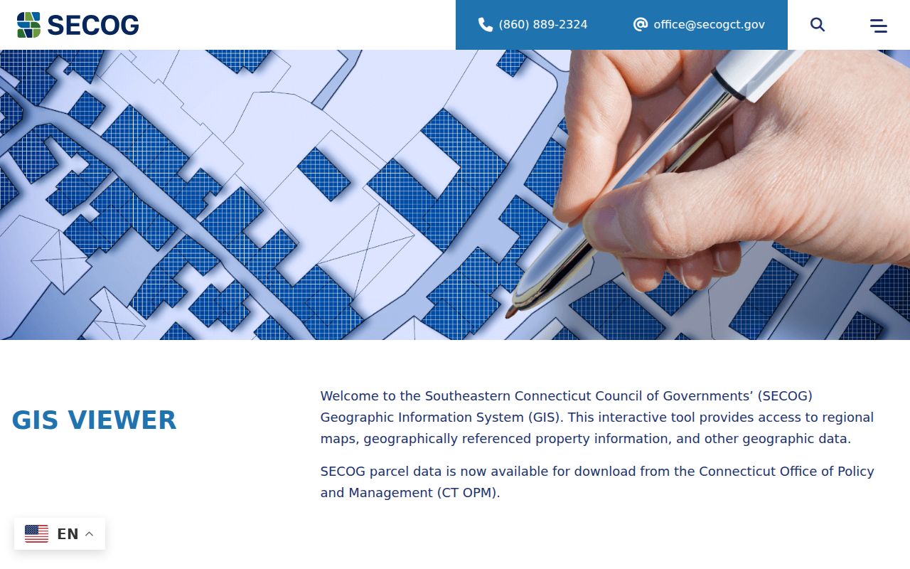
An abutter or mailing-list option identifies a parcel set for a map task. It should not be republished as a list of household members, and it should be checked against the originating assessor or town clerk.
New London VGSI and ZIP Questions
The New London VGSI assessment database reports values at 70 percent of fair market value as of the October 1, 2023 revaluation. A parcel card is expected to connect an owner or taxpayer name with a situs, mailing address, parcel identifier, land and building values, total assessment, and any visible exemption or sketch fields. The live form is dynamic, so exact search labels, required fields, and result pagination were not exposed in the research capture.
The New London VGSI assessor database screenshot shows the public assessment interface and revaluation notice used for parcel research.
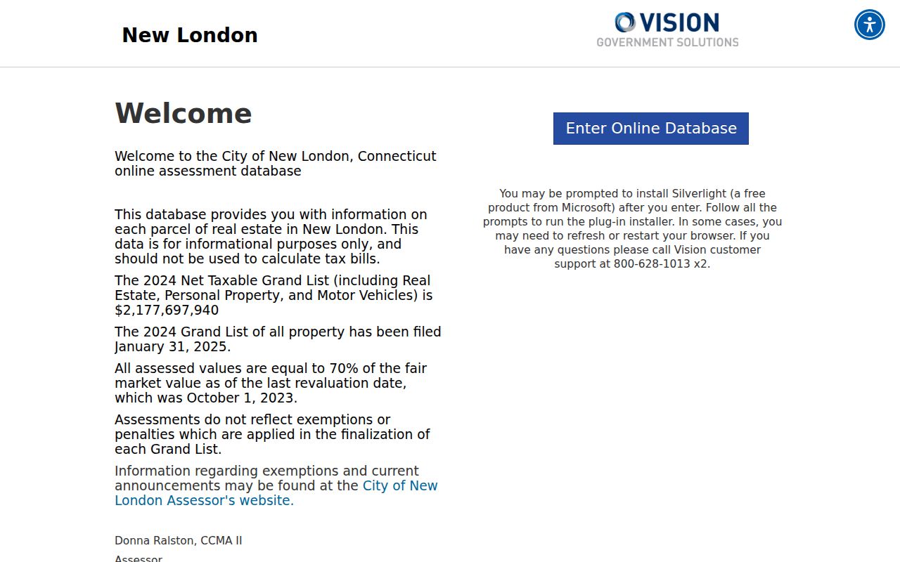
Assessment information is informational and may not reflect exemptions or penalties applied to the final grand list. A mailing destination can be outside the parcel town, and an owner, trustee, business, or taxpayer is not automatically a person who occupies the situs.
New London County Mystic ZIP Geography
Mystic is the clearest local example of a postal label crossing legal-town expectations. The village is documented in both Groton and Stonington, so a 06355 result does not tell a researcher which town clerk or assessor to use. The same caution applies to Pawcatuck and Stonington labels, and to postal names such as Old Mystic or West Mystic that can describe a route or village rather than a civil government.
The USPS West Mystic location record lists 55 West Mystic Avenue with ZIP 06388-9992 and nearby Mystic, Old Mystic, and Noank destinations. That is a delivery clue. Verify the complete street address in a municipal GIS or assessor before requesting a deed, voter record, vital certificate, or court record.
This geography is useful for family history too. A directory or newspaper may print a village name, while a later deed or vital record names Groton or Stonington. Preserve both labels and the source date rather than forcing the older entry into a modern town field.
New London County 06334 and 06389
The 2019 USPS Postal Bulletin expanded delivery use of 06389 Yantic and 06334 Bozrah. This is a useful local timing clue when an older address appears under a narrower postal label and a later address uses the code more broadly. It does not establish a new civil boundary, a parcel transfer, or a current residence.
When a historical person search turns on either ZIP, compare the printed address with a town map, the assessor parcel, the deed’s legal description, and a library directory or newspaper. Postal changes can alter how an address is written while the land record remains keyed to the municipality. Note the edition or bulletin date beside the ZIP.
Note: Postal expansion explains a delivery change, not a countywide readdressing timeline; no official New London County E911 timeline was located.
New London County Address Fields
Four address fields can describe the same property in different ways. Keeping them separate is the main quality check in a ZIP code directory. The postal address is formatted for delivery. The situs is the mapped location of the parcel. The mailing address is where tax or assessment correspondence is sent. The legal description is the deed’s lot, map, subdivision, or metes-and-bounds wording.
- ZIP code
- A five-digit postal delivery area used by USPS. It is not a civil town or parcel boundary.
- ZIP+4
- A four-digit extension that can narrow delivery routing beyond the five-digit code.
- PO-box ZIP
- A code used mainly for post-office boxes or a facility route, not necessarily a residential street.
- Unique ZIP
- A code tied to a single institution or major facility, such as a base or campus.
- Carrier route
- A delivery path within a postal area. It is a routing concept, not a neighborhood roster.
- Situs address
- The parcel’s mapped location used by an assessor or GIS viewer.
- Legal description
- The deed’s formal land wording, which can remain useful when a street name changes.
New London County parcel-number syntax was not confirmed from a static page. Stonington’s official GIS example uses parcel ID 79-1-24 and Unique ID 4222, but that format must not be applied to Groton, Norwich, New London, or another town without a local capture.
New London County ZIP Boundaries
A ZIP code directory can narrow delivery geography, but it cannot answer every records question. Town lines control the clerk, assessor, registrar, and many local requests. Village and facility labels can sit inside a town that is not printed as the postal city. A ZIP can also reach across a town line, as the Mystic and Pawcatuck examples show. Always retain the town chosen from the full address, not only the postal name.
If a parcel, permit, deed, E911 number, or historic address remains unclear, ask the town planning, GIS, engineering, emergency-services, assessor, or clerk office that holds the relevant record. No countywide E911, annexation, street-renumbering, or readdressing timeline was verified in the research. A narrow request under the Connecticut Freedom of Information Act should name the town, address, record type, date range, and preferred format. FOIA covers an existing record, not a new countywide ZIP database.
Boundary check. USPS validates delivery. The municipality validates the legal town, parcel, and custodian. Keep both answers in the research note and do not substitute one for the other.
A complete ZIP search therefore ends with a dated chain: USPS address result, legal town, parcel or map check, record custodian, and the access limit for the requested record. That chain makes a postal clue useful without turning it into an unsupported claim about who lives there.